New publication on sea-ice topographic retrieval using TanDEM-X imagery
This Open Access publication in the journal The Cryosphere presents a novel model for the snow-covered sea ice topographic retrieval using polarimetric SAR interferometry.
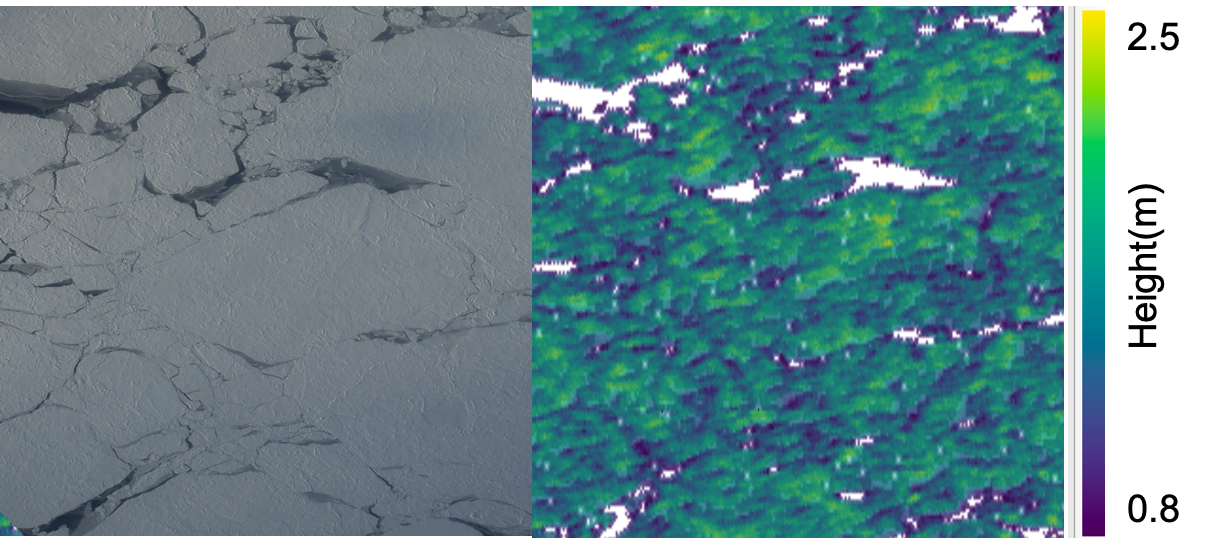
Single-pass interferometric synthetic aperture radar (InSAR) such as TanDEM-X enables the possibility for deriving sea-ice digital elevation model (DEM) despite the inherent dynamics of sea ice. However, the height bias induced by the penetration of electromagnetic waves into snow and ice leads to inaccuracies of the InSAR DEM, especially for the thick and deformed sea ice with snow cover.
In this publication, with the potential of retrieving sea ice geophysical information by the polarimetric-interferometry technique, a two-layer-plus-volume model is proposed to correct the penetration bias and to generate a precise sea ice topographic map from TanDEM-X. Excellent performance for sea ice topographic retrieval from the proposed method is validated with the photogrammetric DEMs from a coordinated campaign over the snow-covered thick and deformed sea ice in the western Weddell Sea, Antarctica.
Huang, L., Fischer, G., and Hajnsek, I.: Antarctic snow-covered sea ice topography derivation from TanDEM-X using polarimetric SAR interferometry, The Cryosphere, 15, 5323–5344, external page https://doi.org/10.5194/tc-15-5323-2021